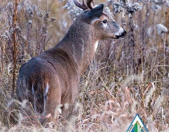
Body
- CA = Conservation Area
- CP = County Park
- ML= Management Lands
- NWR = National Wildlife Refuge
- SP = State Park
- WA =Wildlife Area
Body
| Hunt # | Area Name | Hunt Quota | # Hunters Drawn | # of Hunters | % Chance to be Drawn | # of Parties | Avg Party Size | Avg Pref Points | Max Avg Pref Points | Doe | Button Buck | Buck | Total Harvest | # of Successful Hunters | Hunter Success Rate |
|---|---|---|---|---|---|---|---|---|---|---|---|---|---|---|---|
| 1 | Blue and Gray County Park | 30 | 33 | 398 | 8.29% | 164 | 2.43 | 2.13 | 12 | 17 | 5 | 5 | 27 | 19 | 57.58% |
| 2 | Blue River Parkway County Park Zone 1 | 15 | 18 | 100 | 18.00% | 52 | 1.92 | 2.17 | 8 | 13 | 2 | 5 | 20 | 15 | 83.33% |
| 3 | Blue River Parkway County Park Zone 2 | 20 | 20 | 72 | 27.78% | 30 | 2.4 | 2 | 7 | 11 | 2 | 7 | 20 | 11 | 55.00% |
| 4 | Blue River Parkway County Park Zone 3 | 10 | 11 | 76 | 14.47% | 39 | 1.95 | 1.69 | 6 | 5 | 3 | 4 | 12 | 7 | 63.64% |
| 5 | Blue River Parkway County Park Zone 4 | 10 | 11 | 61 | 18.03% | 26 | 2.35 | 2.5 | 6 | 7 | 1 | 2 | 10 | 8 | 72.73% |
| 6 | Blue Springs Lake (Jackson County Park) | 20 | 21 | 313 | 6.71% | 142 | 2.2 | 2.75 | 13 | 14 | 2 | 6 | 22 | 12 | 57.14% |
| 7 | Cape Girardeau City | 8 | 11 | 104 | 10.58% | 64 | 1.63 | 3.06 | 14 | 6 | 0 | 1 | 7 | 5 | 45.45% |
| 8 | Cape Girardeau City | 8 | 9 | 33 | 27.27% | 20 | 1.7 | 1.6 | 6 | 1 | 1 | 1 | 3 | 2 | 22.22% |
| 9 | Cape Girardeau City | 8 | 8 | 16 | 50.00% | 10 | 1.6 | 1.4 | 6 | 1 | 1 | 0 | 2 | 2 | 25.00% |
| 10 | Cape Girardeau City | 8 | 9 | 18 | 50.00% | 12 | 1.5 | 3.17 | 10 | 1 | 0 | 0 | 1 | 1 | 11.11% |
| 11 | Cape Girardeau City | 8 | 10 | 27 | 37.04% | 11 | 2.45 | 2.64 | 8 | 0 | 0 | 0 | 0 | 0 | 0.00% |
| 12 | Fellows Lake County Park | 35 | 35 | 285 | 12.28% | 146 | 1.97 | 1.49 | 12 | 18 | 2 | 9 | 29 | 15 | 42.86% |
| 13 | Fellows Lake County Park | 25 | 25 | 65 | 38.46% | 33 | 1.97 | 1.45 | 6 | 10 | 4 | 0 | 14 | 9 | 36.00% |
| 14 | Lake Jacomo - West | 15 | 18 | 187 | 9.63% | 91 | 2.05 | 2.74 | 10 | 14 | 5 | 8 | 27 | 16 | 88.89% |
| 15 | Lake Jacomo - East | 25 | 25 | 337 | 7.42% | 139 | 2.42 | 2.47 | 11 | 24 | 2 | 8 | 34 | 19 | 76.00% |
| 16 | Lake Springfield | 15 | 15 | 128 | 11.72% | 78 | 1.64 | 1.55 | 7 | 2 | 1 | 1 | 4 | 3 | 20.00% |
| 17 | Landahl Park County Park | 20 | 20 | 118 | 16.95% | 59 | 2 | 1.63 | 6 | 8 | 0 | 1 | 9 | 8 | 40.00% |
| 18 | Longview Lake County Park | 30 | 32 | 444 | 7.21% | 189 | 2.36 | 2.7 | 11 | 17 | 2 | 3 | 22 | 17 | 53.13% |
| 19 | Longview Lake County Park | 30 | 30 | 137 | 21.90% | 61 | 2.26 | 2.23 | 10 | 7 | 1 | 2 | 10 | 8 | 26.67% |
| 20 | Lost Valley Fish Hatchery (Portion of Area Closed to Hunting) | 6 | 6 | 17 | 35.29% | 13 | 1.31 | 1.69 | 4 | 2 | 0 | 0 | 2 | 2 | 33.33% |
| 21 | Monkey Mountain County Park | 15 | 18 | 135 | 13.33% | 59 | 2.29 | 2.47 | 11 | 9 | 2 | 3 | 14 | 10 | 55.56% |
| 22 | Shaw Nature Reserve | 10 | 5 | 5 | 100.00% | 5 | 1 | 0 | 0 | 0 | 0 | 1 | 1 | 1 | 20.00% |
| 23 | Springfield Conservation Nature Center | 5 | 5 | 91 | 5.49% | 59 | 1.54 | 2.25 | 9 | 2 | 0 | 0 | 2 | 2 | 40.00% |
| 24 | August A. Busch Memorial Conservation Area | 150 | 150 | 260 | 57.69% | 133 | 1.95 | 0.92 | 7 | 18 | 5 | 13 | 36 | 29 | 19.33% |
| 25 | August A. Busch Memorial Conservation Area | 150 | 152 | 665 | 22.86% | 310 | 2.15 | 1.78 | 12 | 13 | 5 | 7 | 25 | 23 | 15.13% |
| 26 | August A. Busch Memorial Conservation Area | 300 | 302 | 936 | 32.26% | 329 | 2.86 | 1.42 | 11 | 20 | 6 | 8 | 34 | 24 | 7.95% |
| 27 | Bicentennial Conservation Area | 30 | 33 | 161 | 20.50% | 76 | 2.12 | 1.55 | 7 | 6 | 0 | 9 | 15 | 12 | 36.36% |
| 28 | Burr Oak Woods Conservation Area | 13 | 14 | 90 | 15.56% | 48 | 1.88 | 2 | 7 | 6 | 0 | 4 | 10 | 6 | 42.86% |
| 29 | Burr Oak Woods Conservation Area | 13 | 13 | 33 | 39.39% | 19 | 1.74 | 2.16 | 8 | 2 | 0 | 5 | 7 | 5 | 38.46% |
| 30 | Bushwhacker Lake Conservation Area | 100 | 100 | 411 | 24.33% | 186 | 2.21 | 1.19 | 10 | 18 | 5 | 10 | 33 | 28 | 28.00% |
| 31 | Caney Mountain Conservation Area | 100 | 85 | 85 | 100.00% | 34 | 2.5 | 0.29 | 2 | 6 | 3 | 2 | 11 | 9 | 10.59% |
| 32 | Columbia Bottom Conservation Area | 40 | 40 | 105 | 38.10% | 58 | 1.81 | 1.1 | 7 | 4 | 1 | 3 | 8 | 6 | 15.00% |
| 33 | Columbia Bottom Conservation Area | 40 | 41 | 80 | 51.25% | 31 | 2.58 | 0.81 | 4 | 2 | 0 | 1 | 3 | 3 | 7.32% |
| 34 | Creve Coeur County Park | 30 | 30 | 329 | 9.12% | 165 | 1.99 | 1.74 | 13 | 20 | 3 | 8 | 31 | 17 | 56.67% |
| 35 | Fabick Nature Preserve | 20 | 20 | 90 | 22.22% | 48 | 1.88 | 2.08 | 10 | 15 | 0 | 2 | 17 | 9 | 45.00% |
| 36 | Fabick Nature Preserve | 20 | 20 | 54 | 37.04% | 23 | 2.35 | 2.17 | 7 | 13 | 2 | 0 | 15 | 10 | 50.00% |
| 37 | Fabick Nature Preserve | 20 | 20 | 24 | 83.33% | 12 | 2 | 1.5 | 3 | 7 | 0 | 0 | 7 | 7 | 35.00% |
| 38 | Forest 44 Conservation Area | 75 | 75 | 165 | 45.45% | 81 | 2.05 | 0.95 | 4 | 4 | 1 | 2 | 7 | 6 | 8.00% |
| 39 | Forest 44 Conservation Area | 100 | 100 | 129 | 77.52% | 63 | 2.05 | 0.73 | 4 | 3 | 2 | 3 | 8 | 8 | 8.00% |
| 40 | Greensfelder County Park | 30 | 30 | 106 | 28.30% | 57 | 1.86 | 1.37 | 8 | 19 | 4 | 10 | 33 | 18 | 60.00% |
| 41 | James A Reed Wildlife Area | 40 | 13 | 13 | 100.00% | 9 | 1.44 | 1.11 | 4 | 0 | 0 | 0 | 0 | 0 | 0.00% |
| 42 | James A Reed Wildlife Area | 50 | 50 | 272 | 18.38% | 140 | 1.94 | 1.3 | 9 | 12 | 0 | 5 | 17 | 15 | 30.00% |
| 43 | Jefferson Barracks County Park | 30 | 32 | 1,045 | 3.06% | 537 | 1.95 | 2.12 | 13 | 45 | 9 | 10 | 64 | 29 | 90.63% |
| 44 | Klamberg (Roger) Woods Conservation Area | 5 | 5 | 55 | 9.09% | 30 | 1.83 | 3.47 | 11 | 3 | 2 | 1 | 6 | 4 | 80.00% |
| 45 | Marais Temps Clair Conservation Area | 20 | 15 | 15 | 100.00% | 9 | 1.67 | 0.78 | 4 | 0 | 0 | 0 | 0 | 0 | 0.00% |
| 46 | Marais Temps Clair Conservation Area | 20 | 19 | 19 | 100.00% | 10 | 1.9 | 1.6 | 7 | 0 | 0 | 0 | 0 | 0 | 0.00% |
| 47 | Otter Slough Conservation Area | 15 | 18 | 26 | 69.23% | 13 | 2 | 1.62 | 7 | 2 | 0 | 0 | 2 | 2 | 11.11% |
| 48 | Otter Slough Conservation Area | 15 | 16 | 103 | 15.53% | 47 | 2.19 | 1.7 | 7 | 1 | 0 | 1 | 2 | 2 | 12.50% |
| 49 | Otter Slough Conservation Area | 15 | 15 | 171 | 8.77% | 73 | 2.34 | 2.95 | 11 | 1 | 0 | 6 | 7 | 7 | 46.67% |
| 50 | Otter Slough Conservation Area | 15 | 17 | 71 | 23.94% | 22 | 3.23 | 2.41 | 10 | 6 | 0 | 0 | 6 | 5 | 29.41% |
| 51 | Otter Slough Conservation Area | 15 | 15 | 72 | 20.83% | 26 | 2.77 | 2.96 | 9 | 0 | 0 | 0 | 0 | 0 | 0.00% |
| 52 | Peck Ranch Conservation Area | 150 | 151 | 395 | 38.23% | 119 | 3.32 | 1.09 | 8 | 4 | 3 | 16 | 23 | 22 | 14.57% |
| 53 | Phantom Forest CA and Bittersweet Woods CA | 5 | 5 | 14 | 35.71% | 11 | 1.27 | 2.55 | 9 | 2 | 1 | 1 | 4 | 2 | 40.00% |
| 54 | Powder Valley Conservation Nature Center | 8 | 8 | 151 | 5.30% | 79 | 1.91 | 3.85 | 13 | 6 | 0 | 2 | 8 | 5 | 62.50% |
| 55 | Queeny Park | 30 | 32 | 184 | 17.39% | 107 | 1.72 | 1.37 | 10 | 26 | 4 | 7 | 37 | 21 | 65.63% |
| 56 | Rockwoods Range | 75 | 76 | 351 | 21.65% | 128 | 2.74 | 1.65 | 11 | 8 | 1 | 6 | 15 | 14 | 18.42% |
| 57 | Rockwoods Range | 75 | 75 | 93 | 80.65% | 45 | 2.07 | 1.09 | 7 | 1 | 1 | 1 | 3 | 3 | 4.00% |
| 58 | Rockwoods Reservation | 12 | 12 | 51 | 23.53% | 32 | 1.59 | 1.41 | 6 | 4 | 1 | 2 | 7 | 5 | 41.67% |
| 59 | Rockwoods Reservation | 12 | 12 | 26 | 46.15% | 14 | 1.86 | 1.21 | 4 | 1 | 2 | 1 | 4 | 3 | 25.00% |
| 60 | Rockwoods Reservation | 12 | 15 | 19 | 78.95% | 13 | 1.46 | 0.69 | 4 | 0 | 0 | 0 | 0 | 0 | 0.00% |
| 61 | Runge Conservation Nature Center | 6 | 6 | 115 | 5.22% | 65 | 1.77 | 2.2 | 13 | 3 | 0 | 1 | 4 | 2 | 33.33% |
| 62 | Weldon Spring Conservation Area | 150 | 119 | 119 | 100.00% | 62 | 1.92 | 0.34 | 4 | 9 | 1 | 3 | 13 | 11 | 9.24% |
| 63 | Weldon Spring Conservation Area | 150 | 150 | 304 | 49.34% | 135 | 2.25 | 0.9 | 6 | 8 | 2 | 9 | 19 | 18 | 12.00% |
| 64 | Weldon Spring Conservation Area | 300 | 299 | 300 | 99.67% | 131 | 2.34 | 0.49 | 5 | 21 | 2 | 6 | 29 | 22 | 7.36% |
| 65 | Whetstone Creek Conservation Area | 75 | 76 | 1,083 | 7.02% | 420 | 2.58 | 3.22 | 14 | 12 | 2 | 11 | 25 | 21 | 27.63% |
| 66 | Babler State Park | 75 | 76 | 217 | 35.02% | 85 | 2.56 | 1.89 | 12 | 32 | 11 | 7 | 50 | 32 | 42.11% |
| 67 | Babler State Park | 75 | 75 | 185 | 40.54% | 74 | 2.53 | 2.05 | 8 | 3 | 2 | 0 | 5 | 5 | 6.67% |
| 68 | Caney Mountain Conservation Area | 200 | 203 | 502 | 40.44% | 152 | 3.3 | 1.3 | 9 | 19 | 9 | 17 | 45 | 42 | 20.69% |
| 69 | Davisdale Conservation Area | 30 | 30 | 70 | 42.86% | 30 | 2.33 | 1.37 | 7 | 13 | 3 | 0 | 16 | 11 | 36.67% |
| 70 | Forest 44 Conservation Area (Jay Henges Range Restricted Portion) | 5 | 5 | 8 | 62.50% | 7 | 1.14 | 0.43 | 2 | 2 | 1 | 1 | 4 | 4 | 80.00% |
| 71 | Forest 44 Conservation Area | 30 | 30 | 217 | 13.82% | 94 | 2.31 | 2.79 | 11 | 2 | 0 | 7 | 9 | 9 | 30.00% |
| 72 | Forest 44 Conservation Area | 30 | 27 | 27 | 100.00% | 14 | 1.93 | 0.93 | 3 | 3 | 2 | 2 | 7 | 6 | 22.22% |
| 73 | James A Reed Wildlife Area | 40 | 40 | 286 | 13.99% | 129 | 2.22 | 2.53 | 13 | 5 | 2 | 14 | 21 | 18 | 45.00% |
| 74 | Mingo National Wildlife Refuge | 80 | 80 | 751 | 10.65% | 255 | 2.97 | 4.09 | 14 | 3 | 0 | 3 | 6 | 5 | 6.25% |
| 75 | Peck Ranch Conservation Area | 200 | 202 | 817 | 24.72% | 219 | 3.73 | 1.99 | 12 | 10 | 3 | 10 | 23 | 22 | 10.89% |
| 76 | Reform Conservation Area | 75 | 78 | 87 | 89.66% | 38 | 2.29 | 1.87 | 11 | 21 | 8 | 0 | 29 | 22 | 28.21% |
| 77 | Watkins Woolen Mill State Park | 75 | 77 | 186 | 41.40% | 85 | 2.19 | 1.44 | 7 | 27 | 7 | 3 | 37 | 25 | 32.47% |
| 78 | Whetstone Creek Conservation Area | 40 | 41 | 413 | 9.93% | 146 | 2.85 | 3.63 | 14 | 19 | 8 | 2 | 29 | 27 | 65.85% |
| 79 | August A. Busch Memorial Conservation Area | 100 | 94 | 94 | 100.00% | 46 | 2.04 | 0.72 | 5 | 14 | 8 | 2 | 24 | 21 | 22.34% |
| 80 | August A. Busch Memorial Conservation Area | 100 | 102 | 745 | 13.69% | 258 | 2.91 | 2.86 | 13 | 8 | 3 | 18 | 29 | 23 | 22.55% |
| 81 | Bushwhacker Lake Conservation Area | 30 | 30 | 104 | 28.85% | 43 | 2.42 | 1.63 | 10 | 1 | 1 | 3 | 5 | 5 | 16.67% |
| 82 | Bushwhacker Lake Conservation Area | 40 | 40 | 97 | 41.24% | 39 | 2.49 | 0.85 | 6 | 5 | 6 | 2 | 13 | 11 | 27.50% |
| 83 | Marais Temps Clair Conservation Area | 20 | 24 | 25 | 96.00% | 11 | 2.27 | 1.09 | 4 | 1 | 0 | 0 | 1 | 1 | 4.17% |
| 84 | Pelican Island Natural Area | 80 | 84 | 199 | 42.21% | 58 | 3.43 | 1.93 | 10 | 25 | 7 | 6 | 38 | 30 | 35.71% |
| 85 | Burr Oak Woods Conservation Area | 15 | 13 | 13 | 100.00% | 12 | 1.08 | 0.58 | 1 | 3 | 0 | 3 | 6 | 5 | 38.46% |
| 86 | Columbia Bottom Conservation Area | 20 | 20 | 107 | 18.69% | 56 | 1.91 | 1.59 | 8 | 0 | 0 | 2 | 2 | 2 | 10.00% |
| 87 | Marais Temps Clair Conservation Area | 20 | 21 | 59 | 35.59% | 25 | 2.36 | 1.96 | 6 | 2 | 0 | 0 | 2 | 1 | 4.76% |
| 88 | August A. Busch Shooting Range and Outdoor Education Center | 3 | 3 | 14 | 21.43% | 13 | 1.08 | 0.31 | 2 | 1 | 0 | 1 | 2 | 2 | 66.67% |
| 89 | Clarence Cannon National Wildlife Refuge | 15 | 15 | 488 | 3.07% | 200 | 2.44 | 4.02 | 14 | 1 | 1 | 0 | 2 | 2 | 13.33% |
| 90 | Cuivre River State Park | 150 | 151 | 634 | 23.82% | 252 | 2.52 | 2.14 | 11 | 102 | 21 | 22 | 145 | 72 | 47.68% |
| 91 | Deer Ridge Conservation Area | 25 | 25 | 70 | 35.71% | 30 | 2.33 | 1.03 | 4 | 2 | 0 | 0 | 2 | 2 | 8.00% |
| 92 | Knob Noster State Park | 100 | 100 | 704 | 14.20% | 272 | 2.59 | 1.79 | 9 | 60 | 26 | 16 | 102 | 53 | 53.00% |
| 93 | Pershing State Park | 60 | 62 | 357 | 17.37% | 120 | 2.98 | 2.09 | 13 | 46 | 12 | 9 | 67 | 35 | 56.45% |
| 94 | Pomme de Terre State Park (Pittsburg) | 10 | 10 | 154 | 6.49% | 88 | 1.75 | 2.19 | 10 | 12 | 5 | 1 | 18 | 9 | 90.00% |
| 95 | Prairie Fork Conservation Area | 8 | 10 | 67 | 14.93% | 27 | 2.48 | 2.37 | 11 | 5 | 0 | 0 | 5 | 4 | 40.00% |
| 96 | Talbot Conservation Area | 40 | 40 | 51 | 78.43% | 21 | 2.43 | 0.43 | 2 | 4 | 3 | 0 | 7 | 5 | 12.50% |
| 97 | Shaw Nature Reserve | 6 | 6 | 10 | 60.00% | 10 | 1 | 0.6 | 5 | 1 | 0 | 0 | 1 | 1 | 16.67% |
| 98 | Shaw Nature Reserve | 6 | 6 | 10 | 60.00% | 10 | 1 | 0.3 | 1 | 0 | 0 | 0 | 0 | 0 | 0.00% |
| 99 | St. Francois State Park | 60 | 62 | 396 | 15.66% | 150 | 2.66 | 2.03 | 11 | 18 | 2 | 1 | 21 | 14 | 22.58% |
| 100 | St. Joe State Park | 80 | 81 | 695 | 11.65% | 247 | 2.81 | 2.07 | 12 | 51 | 8 | 7 | 66 | 32 | 39.51% |
| 101 | Stockton Lake State Park | 60 | 60 | 273 | 21.98% | 96 | 2.84 | 1.55 | 9 | 56 | 11 | 12 | 79 | 39 | 65.00% |
| 102 | Weldon Spring Conservation Area | 100 | 68 | 68 | 100.00% | 37 | 1.84 | 0.24 | 2 | 6 | 0 | 0 | 6 | 6 | 8.82% |
| 103 | Weldon Spring Conservation Area | 100 | 101 | 511 | 19.77% | 222 | 2.3 | 2.42 | 11 | 3 | 1 | 18 | 22 | 22 | 21.78% |
| 104 | Whetstone Creek Conservation Area | 65 | 67 | 168 | 39.88% | 57 | 2.95 | 1.4 | 9 | 52 | 12 | 0 | 64 | 38 | 56.72% |
| 105 | Columbia Bottom Conservation Area | 15 | 11 | 11 | 100.00% | 11 | 1 | 0.27 | 1 | 2 | 0 | 0 | 2 | 2 | 18.18% |
| 106 | August A. Busch Memorial Conservation Area | 60 | 61 | 81 | 75.31% | 66 | 1.23 | 0.26 | 1 | 8 | 3 | 6 | 17 | 17 | 27.87% |
| 107 | Bushwhacker Lake Conservation Area | 10 | 11 | 24 | 45.83% | 19 | 1.26 | 0.32 | 2 | 1 | 0 | 5 | 6 | 6 | 54.55% |
| 108 | Davisdale Conservation Area | 35 | 35 | 45 | 77.78% | 37 | 1.22 | 0.08 | 1 | 12 | 5 | 1 | 18 | 13 | 37.14% |
| 109 | Mingo National Wildlife Refuge | 40 | 40 | 93 | 43.01% | 73 | 1.27 | 0.52 | 4 | 3 | 2 | 3 | 8 | 8 | 20.00% |
| 110 | Ozark National Scenic Riverways - Big Spring Area | 10 | 10 | 16 | 62.50% | 13 | 1.23 | 0.08 | 1 | 9 | 4 | 1 | 14 | 9 | 90.00% |
| 111 | Peck Ranch Conservation Area | 65 | 65 | 85 | 76.47% | 68 | 1.25 | 0.21 | 4 | 14 | 2 | 7 | 23 | 23 | 35.38% |
| 112 | Smithville Lake Management Lands | 30 | 30 | 59 | 50.85% | 51 | 1.16 | 0.1 | 1 | 14 | 3 | 5 | 22 | 17 | 56.67% |
| 113 | Swan Lake National Wildlife Refuge | 15 | 15 | 109 | 13.76% | 86 | 1.27 | 0.34 | 3 | 0 | 0 | 3 | 3 | 3 | 20.00% |
| 114 | Weldon Spring Conservation Area | 60 | 59 | 59 | 100.00% | 47 | 1.26 | 0.06 | 2 | 3 | 2 | 13 | 18 | 18 | 30.51% |
| 115 | Swan Lake National Wildlife Refuge | 10 | 10 | 46 | 21.74% | 42 | 1.1 | 1.43 | 7 | 1 | 0 | 6 | 7 | 6 | 60.00% |
| 116 | Bois D'Arc Conservation Area | 8 | 8 | 12 | 66.67% | 11 | 1.09 | 0.73 | 3 | 3 | 0 | 1 | 4 | 2 | 25.00% |